Corridor Cities Economic Analysis and Land Use Study

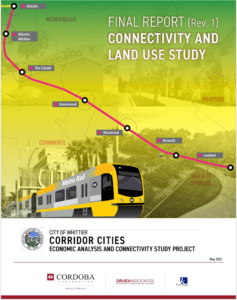
A poster of a train Description automatically generated

Project Name

Corridor Cities Economic Analysis and Land Use Study

Client

The City of Whittier, serving as the lead for the coalition

Sector

Transportation

Overview


The Washington Boulevard Coalition, comprising the cities of Commerce, Montebello Pico Rivera, Santa Fe Springs, and Whittier (as lead) sought to take a regional approach to studying relevant opportunities, economic analysis of impacts, and beneficial opportunities of the proposed Washington Boulevard Corridor Gold Line LRT alignment (now referred to as the Eastside L Line). Understanding the impact of a light rail alignment on the region, the Coalition needed information that would help them in formulating plans to stimulate economic development, produce livable and sustainable communities and reduce long-term traffic congestion along this light rail extension from East Los Angeles to the City of Whittier. More specifically, their requested study aimed to review the development opportunities around each of the seven proposed stations and prepare a development vision and recommendations, for each location, that could be implemented individually by each of the Coalition cities.

Cordoba’s Role


Cordoba’s team of experts, including Gruen Associates and Kosmot, were responsible for evaluating the land use within the project study area and developing and submitting the draft and final versions of the mobility/connectivity, land use and economic analysis reports. The main focus of the “Corridor Cities – Connectivity and Land Use Study” was to explore and identify potential pedestrian, bike, bus, and other modes linkages and urban design considerations around the future transit stations. The seven proposed stations on this route could become high-impact regional connection points ripe for large-scale transit oriented development (TOD) that would: 1) foster growth through densification instead of sprawl; 2) increase livability and sustainability through mixed use and walkable village type development connected via light rail and existing mass transit routes; 3) provide economic opportunity for local residents isolated by existing transit patterns; 4) provide first/last mile options; and 5) provide investment opportunity for both entrepreneurs and existing employers.


The Cordoba team discussed with each city the types of recommendations that were desired so as not to contradict adopted planning efforts and to inform future or ongoing planning efforts. The recommendations were tailored to each city’s needs to provide the most relevant visioning possible. For example, the City of Commerce requested design recommendations for the Citadel expansion project and the City of Whittier requested guidance for the Community Benefits Program established in their General Plan. The resulting study provided an overview of existing conditions, updated maps for the surrounding area and stations, connectivity recommendations and alternatives, and land use considerations.


Given that the preliminary engineering for the corridor was underway, the timeline for the study was limited. The team completed the adopted study in three months.

Services

Planning

Feasibility analysis

Report development

Stakeholder engagement

Share: